Sacandaga Lake Bathymetric Map
Published on: January 6, 2026
2 min read
Overview
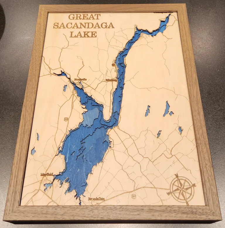
This is a customized, to-scale bathymetric map of Sacandaga Lake, NY that I made as a gift for my parents. I designed the map to be accurate to the region while balancing artistic design and manufacturing constraints.
Design
To accurately represent the lake depth and surrounding features, I referenced two online resources. I used OpenStreetMap for the surrounding roads and these marine maps for the lake depth.
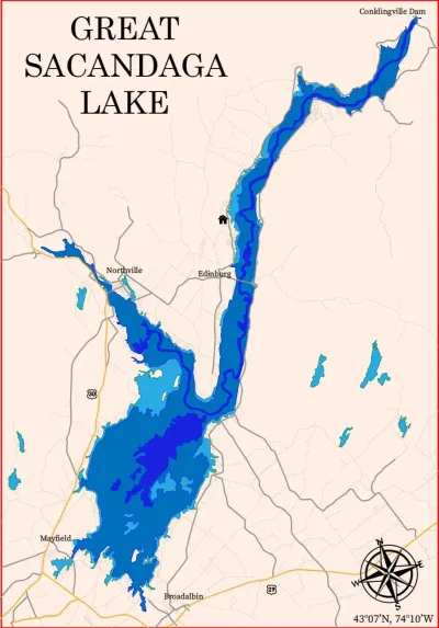
I imported both resources into Adobe Illustrator. OpenStreetMap can export into SVG which made working with the road data easy. However, the marine map could not be exported into a vector format. I was able to use Illustrator’s Image Trace feature to make an SVG of the lake. This worked for the land-lake boundary. However, the depth boundaries could not be accurately traced due to overlapping text and depth contours. Instead, I manually traced the rest of the depth boundaries at 15ft increments.
I then personalized the surface with accents for the title, city names, highway routes and compass. I also rotated the entire piece slightly to reduce the width. This allowed me to increase the scale of the piece while remaining within the 24x15” laser cut bed size.
Process
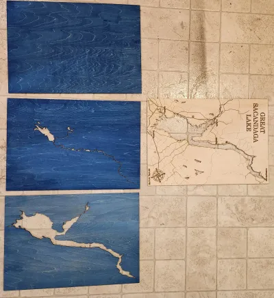
I laser cut 4 1/8” birch sheets for each of the layers. The top layer received additional engrave and etching steps to produce the accents. The bottom 3 sheets received increasing intensities of blue stain to indicate the lake depth. I then squared and glued all the sheets into a single piece. Lastly, I polyurethaned all sides to finish and seal the birch.
This was then placed into a matching walnut frame.
